| Projects | The Rest |
|
|
|


Practical Uses of Google Earth � National Hydrography Dataset (NHD) and STORET Water Quality Sampling Stations
August 18, 2005
1. Practical Uses of Google Earth - National Hydrography Dataset (NHD) and STORET Water Quality Sampling Stations2. Introduction and Motivation
3. The Process
4. Images from Google Earth
5. Practical Uses, Part II
6. Not so practical uses of Google Earth
7. Try this link for fun... it�s from one of my favorite places, Boulder, Colorado
8. Then load the Placemark found here
9. Implementation Ideas
10. KML: the technology behind Google Earth
Introduction and Motivation
I decided to do a little
exploration of Google
Earth (GE) and geospatial data services since my wife is working tonight
and I had an hour or two to play around.
GE is a free software client (with optional paid upgrades) that represents
an exciting rebirth
of a product that allows users to experience spatial data (including 3-dimensional
structures) in an easy to use and dramatic fashion. In fact, one of GE�s greatest
strengths is perhaps its ease of use. Even my mother can now explore geodata
(perhaps even of her back yard) in great detail. I see GE as a great platform
to enable non-environmental scientists to visualize the vast amount of data
and assessment results we have been compiling and publishing in boring reports,
or as GIS data accessible only through expensive software or clumsy and boring websites.
Let me know if you have any
thoughts or suggestions by emailing
The Process
- Stations are derived from shapefiles
created from a download from EPA STORET for the
- Stream flowlines are from high-resolution NHDinGeo from USGS. The lines are grouped by their GNIS Name.
- The data were loaded into an instance of ArcMap 9 and converted to KML with the Shape2KML extension written in VB by Steve Borgstrom (downloaded from ESRI.com ArcScripts).
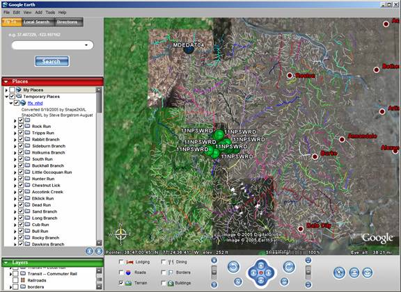
Figure 1. The
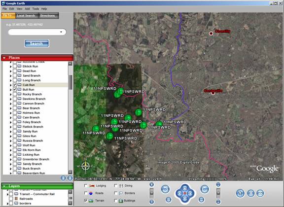
Figure 2. A slightly zoomed in view, with only three named streams enabled (see Places window at the left).

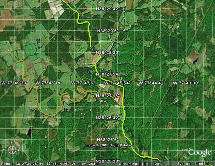
Figure 3. A zoomed in view of a station, I-66 and a named stream. Note the slight offset of the vector stream from the station and aerial photo placement of the stream. This might be because the station and the stream are based on the NAD83 datum, whereas Google earth is based on WGS84. Let�s try this after reprojecting the data.
I decided to do the reprojection using model builder since the reprojection tool in my ArcGIS 9.1 seems a little buggy, and I want to find excuses to use model builder.
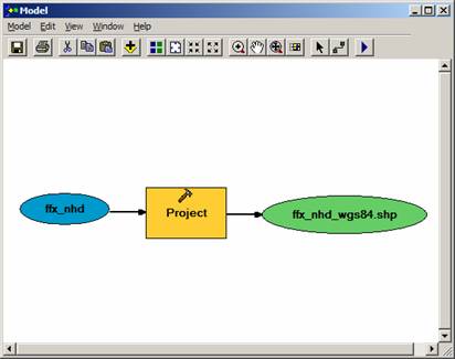
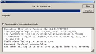
Project ffx_nhd D:\POSTGIS\ffx_nhd_wgs84.shp GEOGCS['GCS_WGS_1984',DATUM['D_WGS_1984',SPHEROID['WGS_1984',6378137.0,298.257223563]],PRIMEM['Greenwich',0.0],UNIT['Degree',0.0174532925199433]] NAD_1983_To_WGS_1984_1
Images (exported from Google Earth as snapshot images).
|
Before reprojection (NAD83) [click] |
After reprojection (WGS84) [click] |
|
So, the NHD offset from the stream in aerial photo was not due to a projection problem. |
As
an aside, the co-registered station appears to be about 11 meters from
the NHD stream. |
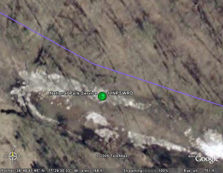
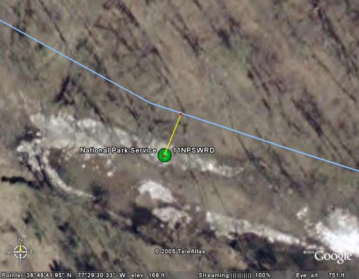
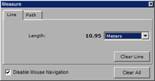

Figure 4. A sideways view of the same area showing topography,
including the
To continue to investigate the practicality of this tool and technology I dabbled with some real data from a recent project. The product is posted below as links to data and screen examples as further illustration of the utility of tools like GE and public data for visualizing environmental data in a more complete context than in traditional GIS displays drawing data from a single, central source. Download these KMZ (compressed KML XML) files to your hard drive and File/Open them in Google Earth to load the data for viewing.
|
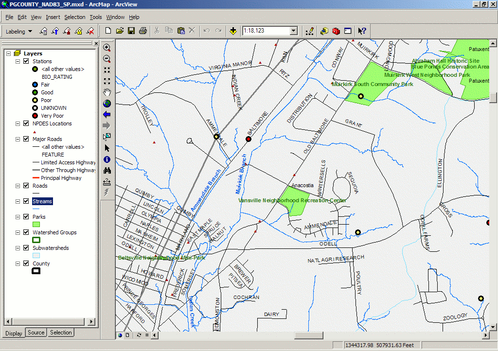
An image of the source GIS data in ArcView. Notice that while you can see the position of the stations relative to the features in the other layers, the exact context of land use and surrounding features is hard to grasp or is missing entirely. For example, you would have a hard time answering questions such as, "What is the land use or land cover type? Are there relevant commercial point sources of impact nearby? Are there artificial hydrologic diversions along the flow paths?" Adding the publicly available data layers provided by Google gives you added information to answer these questions. See the screens below and compare them to this vector-only GIS image. |
|
|
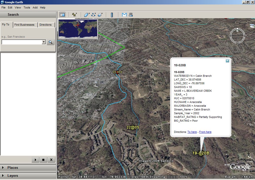
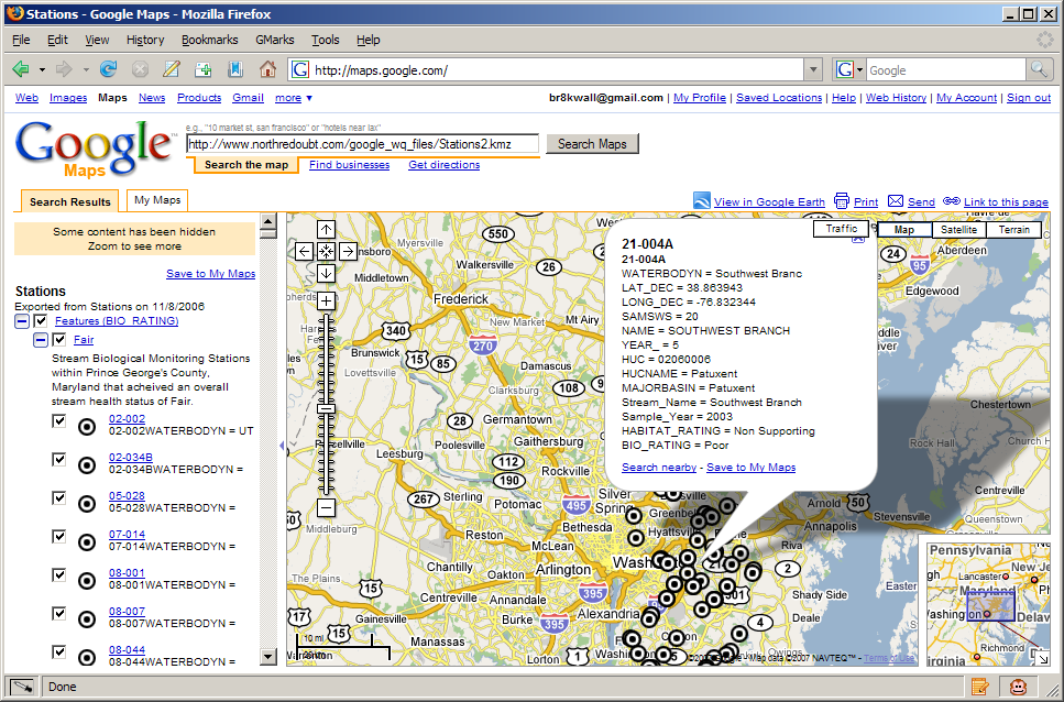
An oblique, zoomed view of a few stations illustrating different biological quality ratings. The image also demonstrates the ability of GE to display feature attributes in a popup window. |
|
|
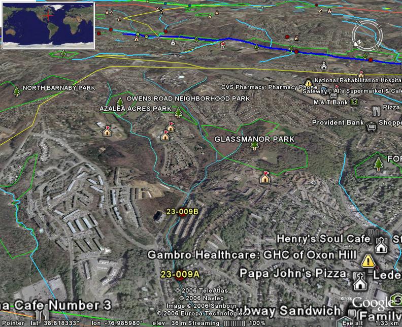
A view of a couple stations of poor biological quality along an urban stream reach located just down-slope from a community of apartment buildings and downstream from a couple urban parks. The significant amount of impervious surface in this drainage as well as the lack of trees in the riparian corridor may be contributing to the impaired biological integrity found at these stations. |
|
|
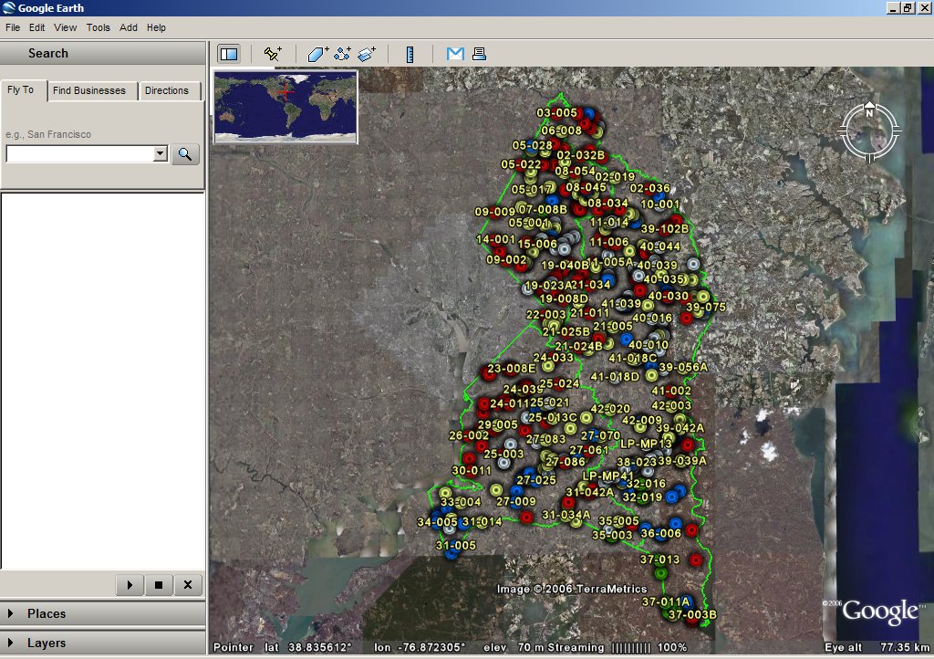
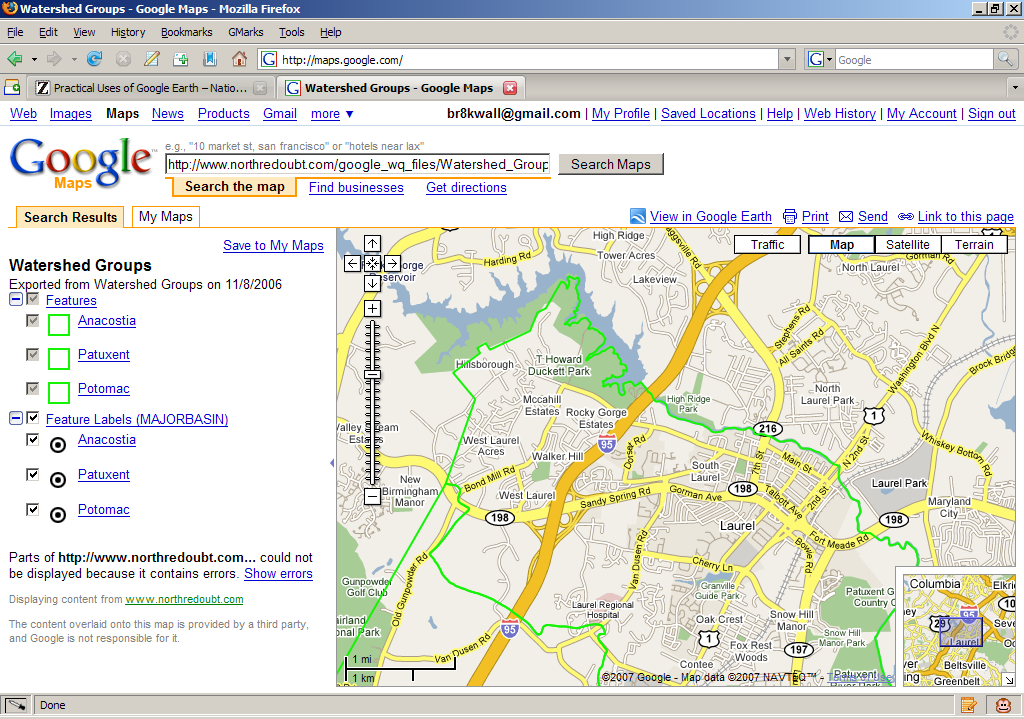
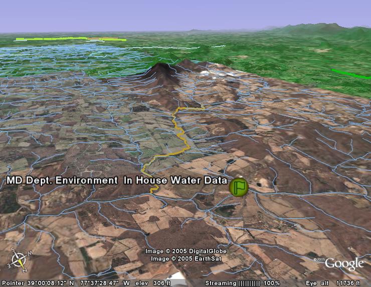
Overall view of the study area. The
green polygon features delineate the major watershed groups of
|
|
|
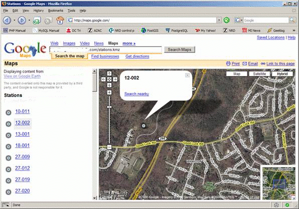
KMZ files can also be opened in Google Maps as an easy way to view the data with nothing but a web browser. Simply paste the URL http://www.northredoubt.com/google_wq_files/Stations2.kmz into the search text field of Google Maps. Here is the Stations file above seen in Google Maps. |
|
|
This view is zoomed out to the extent of the stations in the layer and the station that is selected has more attributes to display, including the IBI score of the site. The Google background is the streets layer to provide better spatial context when zoomed out. |
|
|
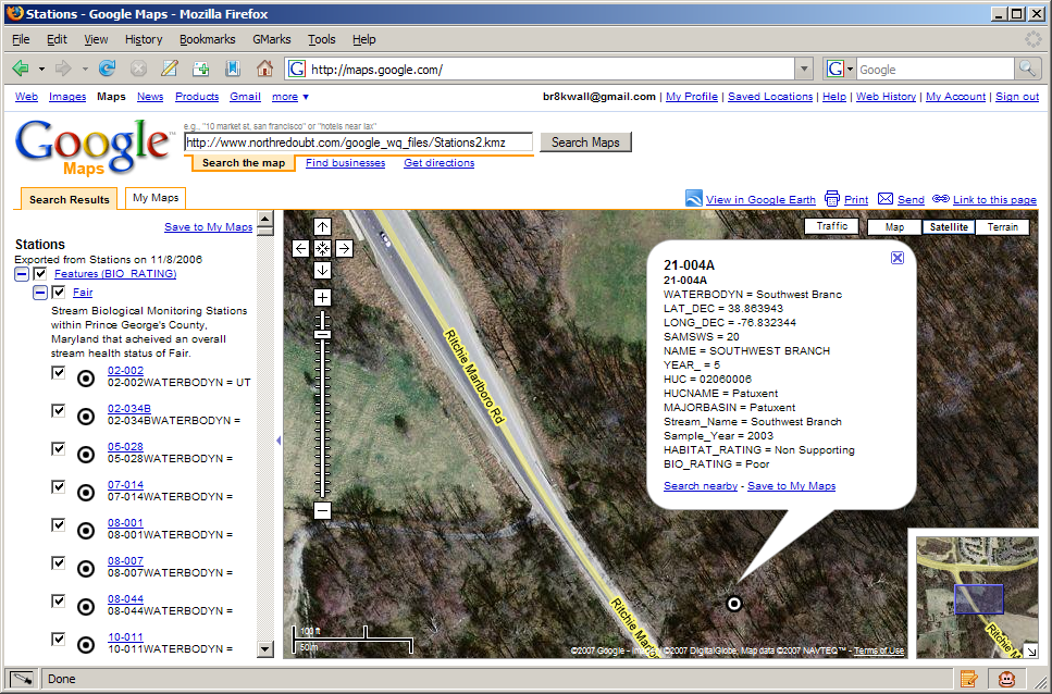
Here is the same station but zoomed closer and the satellite/streets hybrid is shown as the background layer. |
|
|
Recently Google Maps became able to display polygons provided in zipped KML files (.kmz). In this example the major watershed groups of the county are shown as green lines. Note that only "small" files or files that do contain very much geometry (vertices) can be displayed in Google Maps. |
|
|
Network link to our service that streams scale-dependent KML of the National Hydrography Dataset 1:24K (568 B) |
|
|
The stations KML file shown in the images below. (24 KB) |
|
|
The major watershed groups KML file shown in the images below. (422 KB) |
|
|
A KML file of the 303(d) impaired
water bodies for the state of
|
Practical Uses, Part II
Ok, that was fun. Then I wanted to make my little project even more practical. So, I went to EPA and download the 2002 impaired streams GIS layer (aka the 303(d) waters for 2002).
http://www.epa.gov/waters/data/downloads.html
I also used the annoying
little wizard to download a table of the impairments (the pollutant or condition
that lead to
|
|
|
* Note: I tried to build KML (see below) that would let me label the streams with stream names or their impairments like the roads layer that Google provides. After banging my head for an hour I figured why I couldn�t do it. You can�t. At least with KML. See this link. http://bbs.keyhole.com/ubb/showflat.php/Cat/0/Number/63620/an/0/page/3/vc/1
Not so practical uses of Google Earth
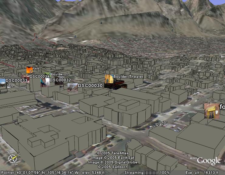
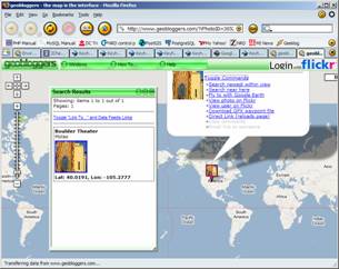
Try this link for fun� it�s from one of my favorite
places,
Boulder,
Colorado.
( http://bbs.keyhole.com/ubb/download.php?Number=71282 )
http://bbs.keyhole.com/ubb/showthreaded.php/Cat/0/Number/71282/page/
|
|
|
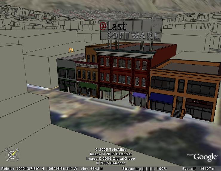
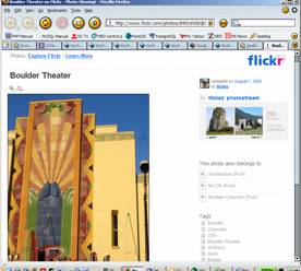
Then load the Placemark found here
(http://bbs.keyhole.com/ubb/download.php?Number=34873
)
And see georeferenced photos that people have taken�
|
|
|
Implementation ideas:
The dominance of the US GIS market by ESRI means that most folks we interact with have their geospatial data assets locked up in ESRI formats; including shapefiles and ArcSDE. With the polished data browser that Google Earth (GE) presents, it seems obvious that there will be a lot of people wanting to enable their business data to be viewed alongside Google�s quality base layers in GE as demonstrated above. ESRI has recognized this [2] and will likely be releasing support for this in their later products. It seems logical that they would allow image and feature services provided by ArcIMS to be exposed as KML perhaps in version 9.2. However, potential licensing and upgrade costs may mean that some data owners will get left behind in the short-term. Plus, some data owners may not want to go to the expense and effort of hosting ArcIMS just to make their data viewable.
So, perhaps what is needed is a java servlet that can produce KMZ�s of multiple data layers from multiple sources (without the need for ArcIMS or ArcAnything in the middle), including Shapefiles and ArcSDE. The servlet would be configurable with XML that would be read by the KMZ servlet when it is started (or restarted). The XML configuration file(s) would be created by an administration servlet. Configuration options would include:
- Adding/Disabling layers from one or more sources (shapefile, ArcSDE, Postgis [2], GRID)
- Controlling the grouping of features by attribute (for coloring and labeling)
- Controlling the colors and labels of the feature groups
- Implement filters
Used in conjunction with other standards-based, non-proprietary technology the world of geospatial data is poised to be opened to the masses. For example, tools like these ([1], [2], [3]) may extend network geodata services to allow round trip data management that can be visualized by GE.
(links above provide more information about supporting technology)
Others are starting work
http://www.digitalearth.com.au/2005/08/09/kml-connector-for-arcims/
Interesting application of PHP
http://www.irongeek.com/i.php?page=videos/wigle1
KML: the technology behind Google Earth
(formerly a product by the folks at Keyhole, a company recently bought by Google).
Docs: http://www.keyhole.com/kml/kml_doc.html
|
Uncompressed KML File |
KML Size |
Compressed KMZ |
KMZ Size |
|
ffx_nhd_wgs84.kmz |
8.9M |
2.4M |
|
|
4.1K |
800B |
||
|
298K |
62K |
Here is a KML snippet of the NHD in this area. These could easily be produced dynamically from a geographically enabled database server.
<?xml version="1.0" encoding="UTF-8" ?>
- <kml xmlns="http://earth.google.com/kml/2.0">
- <Document>
<description>Converted 8/19/2005 by Shape2KML Shape2KML by Steve Borgstrom August 2005, v1.0</description>
<name>snip_nhd</name>
- <Style id="">
- <LineStyle>
<color>FF6DA1DD</color>
<width>2</width>
</LineStyle>
</Style>
- <Style id="
- <LineStyle>
<color>FF6AC105</color>
<width>2</width>
</LineStyle>
</Style>
- <Folder>
<name />
- <Placemark>
<name />
<styleUrl>#</styleUrl>
- <LineString>
<tessellate>1</tessellate>
<coordinates>-77.4833405235035,38.820871006409,0 -77.4833015901702,38.8207618730758,0 -77.4831959901704,38.8205500064095,0 -77.4831159235038,38.8204692730763,0 -77.4831151235038,38.8204472730763,0 -77.4827609235044,38.8201528064101,0 -77.4827305235044,38.8200874730769,0 -77.4827099901711,38.8199012064105,0 -77.4824915901715,38.8196806064108,0 -77.4820929901721,38.8195188730777,0 -77.4815225235063,38.8190640730785,0 -77.4813307901733,38.8190024064119,0 -77.4811359901736,38.8188526730788,0 -77.481066923507,38.818683873079,0 -77.4809139235072,38.8183192064129,0 -77.4796751235092,38.8174172064143,0 -77.479575590176,38.8173808730811,0 -77.4793563235097,38.8173360730811,0 -77.4792227235099,38.8173280064145,0 -77.4790757901768,38.8173476064145,0 -77.4788797235104,38.8173572064144,0 -77.4788243235105,38.8173804064144,0 -77.4786561235107,38.8173894730811,0 -77.4786065901775,38.8173794730811,0 -77.4779109901786,38.8175646064141,0 -77.4777089235122,38.817607206414,0 -77.4774139235127,38.8176024730807,0 -77.4773355235128,38.8175712730808,0 -77.4770103235133,38.8175066730809,0 -77.4767443901804,38.8173256064145,0 -77.4767435901804,38.8173036730812,0 -77.4765963901806,38.8171090730815,0 -77.476570723514,38.8169722730817,0</coordinates>
</LineString>
</Placemark>
- <Placemark>
<name />
<styleUrl>#</styleUrl>
- <LineString>
<tessellate>1</tessellate>
<coordinates>-77.4970919901488,38.8276352730651,0 -77.4974533901482,38.8273254730656,0 -77.4974861234815,38.8272588730657,0 -77.4975063234815,38.8272364730658,0 -77.4975055901482,38.8272144730658,0 -77.497599790148,38.8270972063993,0 -77.497632590148,38.8270306063994,0 -77.4979647234808,38.8266884730666,0 -77.4979709901474,38.8266662730667,0 -77.4980045901474,38.8266270730667,0 -77.4981463234805,38.8264594064003,0 -77.4984329234801,38.8262224730673,0 -77.49843212348,38.8262006064007,0 -77.4984601901467,38.8262000064007,0 -77.4989375234793,38.825794273068,0 -77.4990091901458,38.8256390064016,0 -77.4992813234787,38.825386006402,0 -77.4992945234787,38.825363806402,0 -77.4993217234787,38.8253358064021,0 -77.4993763901452,38.8252962064021,0 -77.4997113234781,38.8246354064031,0 -77.499751923478,38.8245906064032,0 -77.4998057901446,38.82452347307,0 -77.4998441234779,38.8244182730701,0 -77.4999037234778,38.8243126730703,0 -77.4999223901444,38.8242464064037,0 -77.4999679234777,38.8241410730706,0 -77.4999863234776,38.824063806404,0 -77.5000185901443,38.8239862064041,0 -77.5000777234775,38.8238696064043,0 -77.5000891234775,38.8237924730711,0 -77.5001145234774,38.8237150064046,0 -77.5001187901441,38.8236380730714,0 -77.500151390144,38.8235658730715,0 -77.5001839234773,38.8234938730716,0 -77.5002241234773,38.823438006405,0 -77.5002637234772,38.8233658064051,0 -77.5002967234771,38.8233046730719,0 -77.5003237901438,38.8232766064052,0 -77.5003779901437,38.8232206064053,0 -77.5004331901436,38.823191873072,0 -77.5005161234768,38.8231572064054,0 -77.5006131234767,38.8231166730722,0 -77.5006883234765,38.8230600730722,0 -77.5007717234764,38.8230364064056,0 -77.5008611901429,38.8229850730724,0 -77.5009367901428,38.8229394730724,0 -77.5010119901427,38.8228774064059,0 -77.5010531901426,38.8228546064059,0 -77.5011211234759,38.822787206406,0 -77.5011681234758,38.8227258064061,0 -77.5011939901424,38.8226648730729,0 -77.5012409901424,38.8226034064063,0 -77.5013295901422,38.8225246064064,0 -77.5014119901421,38.8224734064065,0 -77.5014863234753,38.8223894730733,0 -77.5015681234752,38.8223218064067,0 -77.5016209901418,38.8222272730735,0 -77.501666923475,38.822133006407,0 -77.5016913901417,38.8220334730738,0 -77.5017521234749,38.821960873074,0 -77.5017979901415,38.8218664730741,0 -77.5018375901414,38.8217942064075,0 -77.5018769234747,38.8217166064077,0 -77.5019029234747,38.8216554730744,0 -77.5019283901413,38.8215836064079,0 -77.5019479901413,38.8215392730746,0 -77.5019653901412,38.8214344730748,0 -77.5019779234745,38.8213902730748,0 -77.5019821901412,38.8213134064083,0 -77.5020143234745,38.8212302064084,0 -77.5020753901411,38.8211686064085,0 -77.5021503234743,38.8211010064086,0 -77.5022893901407,38.8210650064087,0 -77.5025465901403,38.8209936730755,0 -77.5027267234734,38.8209238730756,0 -77.5028451234732,38.8208938064089,0 -77.5030137234729,38.8208956730756,0 -77.5031599901394,38.820865206409,0 -77.5032787234725,38.820846206409,0 -77.503410390139,38.8207994064091,0 -77.5035493901388,38.8207578730758,0 -77.503638723472,38.8207010730759,0 -77.5037689901384,38.820615873076,0 -77.5039051901382,38.8204922064096,0 -77.5040023901381,38.8204626064096,0 -77.5040791901379,38.8204500064096,0 -77.5041711901378,38.8204700064096,0 -77.504284523471,38.8205004730762,0 -77.5044415901374,38.8205740730761,0 -77.5045139901373,38.8206384064093,0 -77.5046075901371,38.8207022730759,0 -77.5047003234703,38.8207442064092,0 -77.5047791234702,38.8207864730758,0 -77.5048701901367,38.8207846064091,0 -77.5049401901366,38.8207776064091,0 -77.5049887901365,38.8207654730758,0 -77.5050515234698,38.8207476730758,0 -77.5051133234697,38.8207078730759,0 -77.5051543234696,38.8206796064093,0 -77.5052025234695,38.820651073076,0 -77.5052703901361,38.8205836730761,0 -77.505345790136,38.8205326730762,0 -77.5054551901358,38.8204478730763,0 -77.505557323469,38.8203578730764,0 -77.5056321901355,38.8202902730766,0 -77.5057693901353,38.8201994730767,0</coordinates>
</LineString>
</Placemark>
- <Placemark>
<name />
<styleUrl>#</styleUrl>
- <LineString>
<tessellate>1</tessellate>
<coordinates>-77.4935635901543,38.8245142064033,0 -77.493745990154,38.82451027307,0 -77.4938433234872,38.8244808064034,0 -77.4939115234871,38.8244244064035,0 -77.493951723487,38.8243686064036,0 -77.4940807234868,38.8242450064037,0 -77.4942187234866,38.8239728730708,0 -77.4942651234865,38.823895073071,0 -77.4943239234864,38.8237674730712,0 -77.494369590153,38.8236676730713,0 -77.494382790153,38.8236454064047,0 -77.4944507234862,38.8235780064048,0 -77.4945509234861,38.8234330730717,0 -77.4947871234857,38.8231588730721,0 -77.4950449234853,38.8229006730725,0 -77.4951209234852,38.8228660730726,0 -77.4952857901516,38.822763806406,0 -77.4954795901513,38.8226828064062,0 -77.4957005234843,38.822573673073,0 -77.4960859901504,38.8223566730733,0 -77.4964761901498,38.8218704730741,0 -77.4965315901497,38.8218474064075,0 -77.496551523483,38.8218140064075,0 -77.4965861234829,38.8217968064075,0 -77.4966131234829,38.8217688064076,0 -77.4966403901495,38.8217462064076,0 -77.4966747234828,38.8217234730743,0 -77.4967159234827,38.8216952064077,0 -77.4967287901494,38.8216620064078,0 -77.4967559234827,38.8216338730745,0 -77.4967893234826,38.8215892064079,0 -77.4968163234825,38.8215558064079,0 -77.4968643234825,38.821521806408,0 -77.4968981901491,38.821488006408,0 -77.4969387234824,38.8214432064081,0 -77.496958590149,38.8214098730748,0 -77.4969719234823,38.8213876064082,0 -77.496991990149,38.8213596730749,0 -77.4970051234823,38.8213320064083,0 -77.4970185234822,38.8213152064083,0 -77.4970457901489,38.8212926064083,0 -77.4970447234822,38.8212598064084,0 -77.4970579901488,38.8212374730751,0 -77.4970713901488,38.8212206730751,0 -77.4971053901488,38.8211924730752,0 -77.4971259234821,38.8211756064085,0 -77.4971321901487,38.8211534730752,0 -77.4971383901487,38.8211314064086,0 -77.497151723482,38.8211092064086,0 -77.4971785901487,38.8210756064087,0 -77.497177923482,38.8210536730754,0 -77.4971981901486,38.8210312064087,0 -77.4972183234819,38.8210034064088,0 -77.4972243234819,38.8209758064088,0 -77.4972303901486,38.8209482064089,0 -77.4972503234819,38.8209148064089,0 -77.4972773234818,38.8208866730756,0 -77.4972965901485,38.820837006409,0 -77.4973229901484,38.8207868730758,0 -77.4973353234817,38.8207372064092,0 -77.4973551901484,38.8207038730759,0 -77.4973821234817,38.820670273076,0 -77.4974813901482,38.8204978730762,0 -77.4975083234815,38.8204644064096,0 -77.4975131901481,38.8204038730764,0 -77.4975485234814,38.8204086730764,0 -77.4978875901476,38.8200662730769,0 -77.4979245234808,38.8199172064105,0 -77.4979719901474,38.8198722730772,0 -77.4980467234806,38.8195960730776,0 -77.4980549234806,38.8194312064112,0 -77.4980559901473,38.8192608730781,0 -77.4980813234806,38.8191834730783,0 -77.4980937234806,38.818936006412,0 -77.4981105234805,38.8188148064122,0 -77.4980963901472,38.8186118730792,0 -77.4980789234806,38.8185134730793,0 -77.4980811901473,38.8183760730795,0 -77.4982767234803,38.8179434730802,0 -77.4983109901469,38.8179208064136,0 -77.4983809901468,38.8177160064139,0 -77.4984087234801,38.8177044064139,0 -77.4984327234801,38.8175886064141,0 -77.49846712348,38.8175658730808,0 -77.4985179234799,38.8174110064144,0 -77.4985205234799,38.8172846064145,0 -77.4986381234797,38.8170350064149,0 -77.4986651901464,38.8170068730816,0 -77.4988255901461,38.8169760730817,0 -77.499099323479,38.8169756730817,0 -77.4991815901456,38.8169190064151,0 -77.4991693901456,38.8167710064153,0 -77.4992429234788,38.8166650730822,0 -77.4992415234788,38.8166266064156,0 -77.4993087901453,38.8165428064157,0 -77.4995057901451,38.8163518730827,0 -77.4995735234783,38.8160812730831,0 -77.4996083234782,38.8158718730834,0 -77.4995997901449,38.8156302730838,0 -77.499510190145,38.815472873084,0 -77.4992563234788,38.8152422064177,0 -77.4992179901455,38.8151496730845,0 -77.4992355901455,38.8150504730847,0 -77.4992671901454,38.8149508730848,0 -77.499508390145,38.814824873085,0 -77.4997061234781,38.8146558730853,0 -77.499747123478,38.8146220730853,0 -77.4998015234779,38.8145714730854,0 -77.4998561901445,38.8145318730855,0 -77.4999035901444,38.8144814730856,0 -77.4999435901444,38.814420206419,0 -77.5000041234776,38.8143420064191,0 -77.5000359901442,38.8142534064193,0 -77.5000681901442,38.8141704064194,0 -77.5000793901442,38.8140876730862,0 -77.5001107234774,38.8139772064197,0 -77.5001427234774,38.8138886730865,0</coordinates>
</LineString>
</Placemark>
- <Placemark>
<name />
<styleUrl>#</styleUrl>
- <LineString>
<tessellate>1</tessellate>
<coordinates>-77.4909639901583,38.8190278730785,0 -77.491147390158,38.8184472730794,0 -77.4913337234911,38.8181522064132,0 -77.4914219234909,38.8180680064133,0 -77.4915755901574,38.8178448730803,0 -77.4916487901572,38.8177280730805,0 -77.4918517901569,38.8175096064142,0 -77.49204852349,38.8173130730812,0 -77.4925041901559,38.8168914064152,0 -77.4927917234888,38.8166820730821,0 -77.4928809234887,38.8166198064156,0 -77.4930823234884,38.8165606064157,0 -77.493305523488,38.8165174064157,0 -77.4937803234873,38.8162436064162,0 -77.4939453901537,38.816146673083,0 -77.4942893234865,38.8159416064166,0 -77.4943985234863,38.8158514064168,0 -77.4945631901527,38.8155402730839,0 -77.494597923486,38.8155286064173,0 -77.4947425901524,38.815047606418,0 -77.4948733901522,38.8147756730851,0 -77.4950311234853,38.8144648064189,0 -77.4951385234852,38.8143252064191,0 -77.495218723485,38.814208073086,0 -77.4954943901513,38.8138618064199,0 -77.4955333901512,38.81377300642,0 -77.4955679234845,38.8137558730867,0 -77.4956209234844,38.8136668064202,0 -77.4959993901505,38.8132468064208,0</coordinates>
</LineString>
</Placemark>
- <Placemark>
<name />
<styleUrl>#</styleUrl>
- <LineString>
<tessellate>1</tessellate>
<coordinates>-77.5009549234761,38.8136296064202,0 -77.5009151234762,38.8136962730868,0 -77.5008547234763,38.81377460642,0 -77.5007943234764,38.8138526730865,0 -77.5007607234764,38.8138974064198,0</coordinates>
</LineString>
</Placemark>
- <Placemark>
<name />
<styleUrl>#</styleUrl>
- <LineString>
<tessellate>1</tessellate>
<coordinates>-77.4839757235025,38.8213736730749,0 -77.4836829235029,38.8210284064087,0 -77.4833405235035,38.820871006409,0</coordinates>
</LineString>
</Placemark>
- <Placemark>
<name />
<styleUrl>#</styleUrl>
- <LineString>
<tessellate>1</tessellate>
<coordinates>-77.5007607234764,38.8138974064198,0 -77.5007047234765,38.8139720064197,0</coordinates>
</LineString>
</Placemark>
- <Placemark>
<name />
<styleUrl>#</styleUrl>
- <LineString>
<tessellate>1</tessellate>
<coordinates>-77.5001427234774,38.8138886730865,0 -77.4999821901443,38.8137162730868,0</coordinates>
</LineString>
</Placemark>
- <Placemark>
<name />
<styleUrl>#</styleUrl>
- <LineString>
<tessellate>1</tessellate>
<coordinates>-77.4959993901505,38.8132468064208,0 -77.4960327901504,38.8131026730877,0</coordinates>
</LineString>
</Placemark>
- <Placemark>
<name />
<styleUrl>#</styleUrl>
- <LineString>
<tessellate>1</tessellate>
<coordinates>-77.5016065234751,38.8127918064215,0 -77.5015201901419,38.8129310064213,0 -77.5013587901422,38.8131320730877,0 -77.5012043234757,38.8133332064207,0 -77.501056323476,38.8135174730871,0 -77.5009549234761,38.8136296064202,0</coordinates>
</LineString>
</Placemark>
</Folder>
- <Folder>
<name>
- <Placemark>
<name>
<styleUrl>#
- <LineString>
<tessellate>1</tessellate>
<coordinates>-77.4960327901504,38.8131026730877,0 -77.4954349901514,38.8127646064216,0 -77.4947329901525,38.8125652730885,0 -77.4933723234879,38.8123966730888,0 -77.4918399234903,38.8117318730898,0 -77.4909189901584,38.8114934064235,0 -77.4905951234922,38.8112640730906,0 -77.4895625234938,38.8098360730928,0 -77.4888731901616,38.8089884730941,0 -77.4888231901616,38.8087644064278,0 -77.4889107901615,38.8084550064283,0 -77.4891753901611,38.8077902064293,0 -77.4892723234943,38.80734880643,0 -77.4893231901608,38.8063920064315,0 -77.4893463234941,38.806045606432,0 -77.489457923494,38.8058234064323,0 -77.4899053901599,38.8051712731,0 -77.4904351901591,38.8044624731011,0 -77.4908821234918,38.8039916064352,0 -77.4916521901572,38.8029260731035,0 -77.4927609234888,38.8019138064384,0 -77.4934785901544,38.8011570731062,0 -77.4940245234869,38.8005082731073,0 -77.4941049234868,38.8001990064411,0 -77.4940605234868,38.7997276064418,0 -77.4940423234869,38.7992062064426,0 -77.4940489234869,38.7989972731096,0</coordinates>
</LineString>
</Placemark>
- <Placemark>
<name>
<styleUrl>#
- <LineString>
<tessellate>1</tessellate>
<coordinates>-77.5047935234702,38.8163922730826,0 -77.5045181901373,38.816151073083,0 -77.5041603234712,38.8159554730833,0 -77.5034869234722,38.8155690064172,0 -77.5030393901396,38.8152216730844,0 -77.5023503901406,38.8147914730851,0 -77.5017273234749,38.8144368730856,0 -77.5011275234759,38.8141476730861,0 -77.5008497234763,38.8140328064196,0 -77.5007047234765,38.8139720064197,0</coordinates>
</LineString>
</Placemark>
- <Placemark>
<name>
<styleUrl>#
- <LineString>
<tessellate>1</tessellate>
<coordinates>-77.5007047234765,38.8139720064197,0 -77.5005503901434,38.8139074064198,0 -77.5002945234772,38.8138140064199,0 -77.4999821901443,38.8137162730868,0</coordinates>
</LineString>
</Placemark>
- <Placemark>
<name>
<styleUrl>#
- <LineString>
<tessellate>1</tessellate>
<coordinates>-77.4999821901443,38.8137162730868,0 -77.4997059234781,38.8136454064202,0 -77.4978891234809,38.8134864730871,0 -77.496526523483,38.8132630064208,0 -77.4960327901504,38.8131026730877,0</coordinates>
</LineString>
</Placemark>
</Folder>
</Document>
</kml>
| Projects | The Rest |