Projects Page
Urban Planning Spatial Analysis
Urban GIS Needs Analysis (PDF, 374 KB))
Internet GIS and scientific metadata (JPG, 128KB)
SeaWiFS in the Great Lakes (PDF, 5.8 MB)
Lake Michigan Primary Production & Climate Change (HTML)
Cartography (HTML)
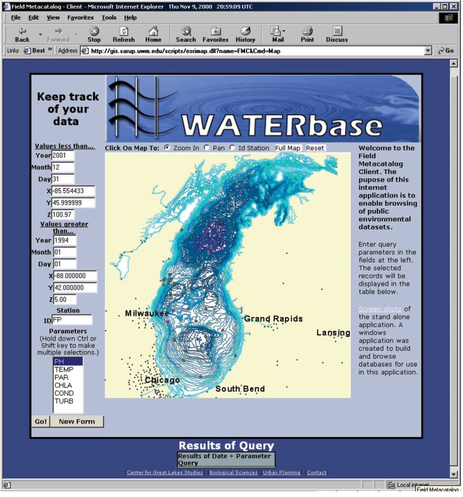
Great Lakes WATER Institute: WATERbase
[FWI]
Online Environmental Database (PDF, 1.8 MB)
Recent weather near Cumberland Center, ME
Thesis Project [Description]
[Presentation]
Limnology Data Resources
Ecology Lab Guidelines
TNTmips Great Lakes Users Group
TNTmips Presentation
St. John Lutheran Church
Introduction to GIS Class Page
Practical Uses of Google Earth, Phase 1
DC Triathlon Club
GeoAnalysis with Google Earth and ArcGIS 9.3 (Google Doc Presentation)
Mary Jane Grant Sign Language Interpreting Services
Home
-
The Rest
-
Links